SHARE
Facebook X Pinterest WhatsApp

SAP Aims to Embed Spatial Data in Business Apps

The Rise of Integrated IT Infrastructure Systems: Top Enterprise Use Cases Spatial data has been steadily working its way into mainstream enterprise applications for years now. Often taking their cue from consumer applications that make extensive use of the data to add more geographic context to the user experience, developers of business applications now want […]

Written By
MV
Mike Vizard
Jun 28, 2016
Slide Show

The Rise of Integrated IT Infrastructure Systems: Top Enterprise Use Cases

Spatial data has been steadily working its way into mainstream enterprise applications for years now. Often taking their cue from consumer applications that make extensive use of the data to add more geographic context to the user experience, developers of business applications now want to be able to routinely make geographic data a part of the business application experience.

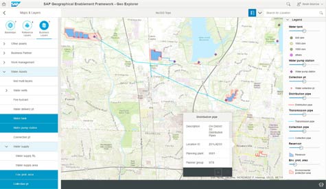
At the Esri User Conference 2016 today, SAP took the wraps off a SAP Geographical Enablement Framework designed to more tightly integrate geographic data created using the ArcGIS system from Esri with the SAP HANA in-memory database platform.

While SAP and Esri have been cooperating with each other for years, Matthew Zenus, vice president of product strategy go-to-market for the Digital Enterprise Platform Group at SAP, says the SAP Geographical Enablement makes it possible to bi-directionally navigate data within SAP HANA applications and ArcGIS. Developers can also use application programming interfaces (APIs) published by GIS systems to fetch geo-spatial data from within a SAP HANA application or, conversely, allow GIS users to access SAP data from within their GIS tools.

GEF-SAP-v22

Because ArcGIS data is now treated as a natural extension of the SAP HANA database, Zenus says it will now be less costly to include spatial data in applications in a way that doesn’t compromise overall application performance.

There’s no doubt that location has been a missing component of business applications that historically have tended to focus more on time and space. Spatial data creates the opportunity to represent that data providing more visual context. The challenge, of course, has always been finding a way to do that without incurring the cost of having an entirely different database just to manage spatial data.

Save

Save

MV

Michael Vizard is a seasoned IT journalist, with nearly 30 years of experience writing and editing about enterprise IT issues. He is a contributor to publications including Programmableweb, IT Business Edge, CIOinsight and UBM Tech. He formerly was editorial director for Ziff-Davis Enterprise, where he launched the company’s custom content division, and has also served as editor in chief for CRN and InfoWorld. He also has held editorial positions at PC Week, Computerworld and Digital Review.

Recommended for you...

Data Lake Strategy Options: From Self-Service to Full-Service
Chad Kime
Aug 8, 2022
What’s New With Google Vertex AI?
Kashyap Vyas
Jul 26, 2022
Data Lake vs. Data Warehouse: What’s the Difference?
Aminu Abdullahi
Jul 25, 2022
IT Business Edge Logo

The go-to resource for IT professionals from all corners of the tech world looking for cutting edge technology solutions that solve their unique business challenges. We aim to help these professionals grow their knowledge base and authority in their field with the top news and trends in the technology space.

Property of TechnologyAdvice. © 2025 TechnologyAdvice. All Rights Reserved

Advertiser Disclosure: Some of the products that appear on this site are from companies from which TechnologyAdvice receives compensation. This compensation may impact how and where products appear on this site including, for example, the order in which they appear. TechnologyAdvice does not include all companies or all types of products available in the marketplace.